Backpacking in Chartreuse
Jul 20, 2022
Weaving through the dancing trees
With heavy pack and worn out knees
I press on through the morning mist
To reach the top and feel the breeze

In the march I hide and seek,
Render straight what was oblique:
The time that's passed, the friendships missed
Await me at the mountain peak

The ridge presents a fickle thing
That ties me down like worn out string
Then raises me into the sky
A cool and stately offering

My thoughts collide atop this mount
As bursting springs become unwound
The people hurt, the things I've tried
But I'm obliged to come back down

So that all I've missed can now be found.
Last weekend, I went on a three-day hike in the Massif de Chartreuse, a mountain range situated between Grenoble and Chambery in southeastern France.
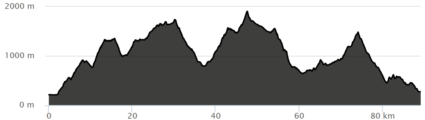
The route (details below) passed through cool forests, sun-baked rock formations, and of course, lots of mountains. In fact, there was virtually no flat section along the 90 km (56 mi) of trail.
This was my first proper backpacking trip, and it went surprisingly well. I packed plenty of food, and I was able to find enough water sources to keep my two giant water pouches topped up.
I originally planned to complete the hike in four days, which would break the hike into four sections, each about 23 km (14 mi) sections. However, the longing for a cold shower and soft bed compelled me to complete the hike in three 30 km sections instead.
The most challenging part of the hike, more than searching for water and finding the energy to climb up and down the mountainsides, was simply finding the trail. I took advantage of France’s extensive “Grand Randonnée” system, which is France’s massive highway system for hiking trails. The GRs stretch all across France, and many are quite popular, but the trails through the Massif de Chartreuse were dicey, often absurdly so.
For example, I would often walk an entire kilometer without finding a trail marker, even when other false trails split off to the side. The trail stretched across bald rock formations with deep, frequent pits that seemed eager to break my legs. In one section, the trail moved straight up a cliff face, so that I had to grip onto thick steel cables with my hands and walk up the side of the cliff, with my heavy backpack wobbling around behind me.
All of these travails were worth it, however, for all the cool fountains that I found as I turned a corner, or for the village bakery I found on the second day, and of course for the moments when I reached the summit and was able to see the world stretch out below me.
I slept “belle étoile”, which means in the open air, with just a sleeping bag and pad. This was not only pleasant thanks to the cool night air and quiet surroundings, but it was in fact the only way to legally sleep along the trail.
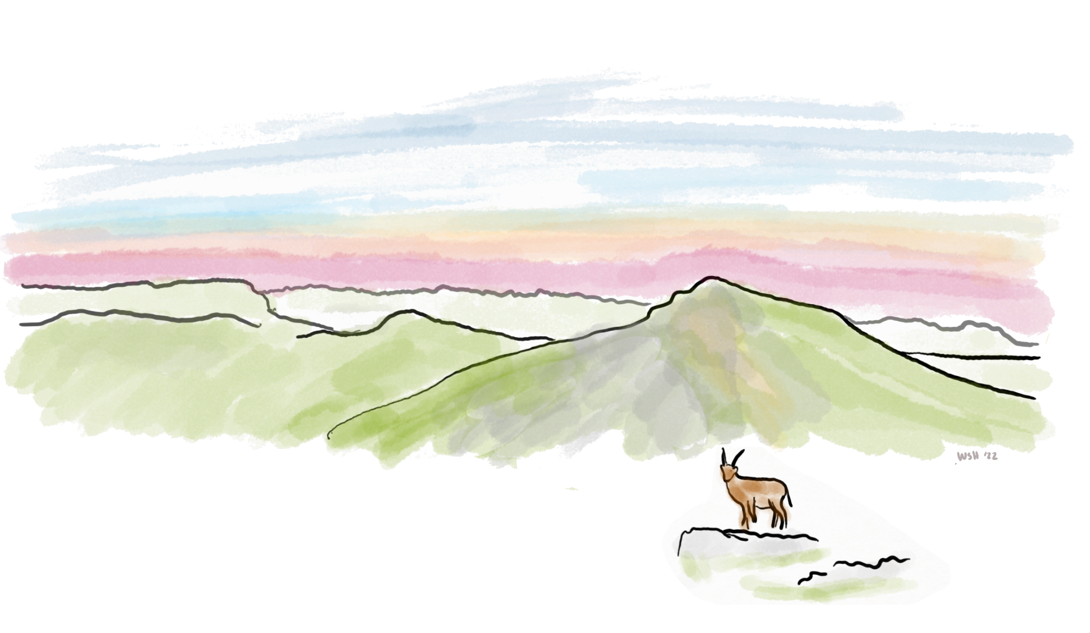
The first night I decided to sleep on the side of a mountain named Charmant Som. I saw on Ibex standing on a rock up there, and if it was good enough for the Ibex, then it must be good enough for me. I quickly realized that the mountain was far too steep to sleep on. Every time I put my head on my pillow, I would begin to actually slide down the face of the mountain, slowly but surely. I was too exhausted to pack all my things and descend the mountain in search of flatter ground, and so I would wake up every two hours through the night and inch my way like a caterpillar back up to my original spot. The view from up there, though, was stunning.
I decided to find a flatter spot on the second night and settled at the base of Mount Granier. There was a cool spigot hidden behind a hill, and I was able to find it by ear. Like the Ibex, the spigot was a good sign to me, and so I settled nearby under a boulder.
On the third morning my phone was nearly dead, and I was determined to make it home before it died competely. However, I still made an attempt to summit Mont Granier. The imposing mountain, which could be seen a hundred miles away, was a serious deviated from my planned route, but there was possibly enough time to do it anyway.
I knew nothing about how to summit Mont Granier besides a dotted red trail on my paper map. I quickly discovered that the way up was much harder than expected. The beginning of the trail was a vertical climb up a limestone cliff, marked only by a faint yellow dot. I followed a narrow trail at the top of the cliff for a kilometer, only for it to peter out. A marmot was waiting at the end, standing on its hind legs with a surprised look on its face.
I found my way again, then discovered that the trail yet again went straight up a cliff. This time there were steel cables that I could use to help me climb, which was a blessing given my heavy backpack. After ascending like this for some time, with the sunrise still warming my back, something changed in me and I realized that I would not have enough time to summit Mont Granier. I was maybe a third of the way up the mountain when I began to descend down the same steel cables. I just did not have enough battery (even with my pone turned off, I wanted enough to call for help), and I was running low on food. I needed to get back to the main trail.
The remaining third of the journey was the easiest physically, but it was where the trail markers all but disappeared. I relied almost entirely on my paper map and compass, guessing how far I had walked and marking off landmarks with a pencil. The mountains yielded to vast green valleys, which then yielded to rocky plains filled with deep and narrow craters like stripes on a tiger.
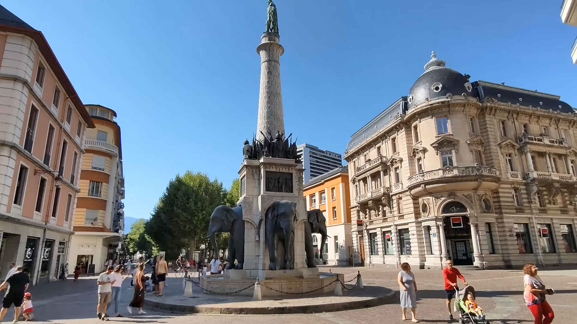
The mountains were separated from civilization by a band of woods. These were the final obstacle, and it was all descent. At some point I was a sign in a forest clearing that simply said “Chambery.” The trees became houses and the houses became streets and in less than an hour I was in the middle of the city, standing under the iconic Fontaine des éléphants. From there, I simply walked to the Chambery train station and took the train back to Grenoble.